
2004, ISBN: 9780917860478
Winner of the Louisiana Endowment for the Humanities 2004 Humanities Book of the Year Award, the Louisiana Library Association’s 2004 Louisiana Literary Award, and the Gulf South Hi… Más…
| BarnesandNoble.com new in stock. Gastos de envío:zzgl. Versandkosten., más gastos de envío Details... |

2003, ISBN: 9780917860478
Historic New Orleans Collection, Hardcover, 430 Seiten, Publiziert: 2003-12-02T00:00:01Z, Produktgruppe: Book, Hersteller-Nr.: 193 maps, 3.72 kg, Books Global Store, Special Features, Boo… Más…
| amazon.co.uk ebooksweb* Gastos de envío:In stock. Die angegebenen Versandkosten können von den tatsächlichen Kosten abweichen. (EUR 5.53) Details... |
2003, ISBN: 9780917860478
Historic New Orleans Collection, Hardcover, 430 Seiten, Publiziert: 2003-12-02T00:00:01Z, Produktgruppe: Book, Hersteller-Nr.: 193 maps, 3.72 kg, Literary Fiction, Literature & Fiction, S… Más…
| amazon.co.uk BOOKS etc Gebraucht, wie neu. Gastos de envío:Usually dispatched within 2 to 3 days. Die angegebenen Versandkosten können von den tatsächlichen Kosten abweichen. (EUR 5.44) Details... |
2003, ISBN: 9780917860478
Historic New Orleans Collection, Hardcover, 430 Seiten, Publiziert: 2003-12-02T00:00:01Z, Produktgruppe: Book, Hersteller-Nr.: 193 maps, 3.72 kg, Literary Fiction, Literature & Fiction, S… Más…
| amazon.co.uk Gastos de envío:Die angegebenen Versandkosten können von den tatsächlichen Kosten abweichen. (EUR 5.44) Details... |

ISBN: 9780917860478
Find Charting Louisiana by Alfred E. Lemmon in Hardcover and other formats in Reference > Atlases, Gazetteers & Maps. Media > Books new, Historic New Orleans Collection
| Booksamillion.com Gastos de envío:Zzgl. Versandkosten., más gastos de envío Details... |

2004, ISBN: 9780917860478
Winner of the Louisiana Endowment for the Humanities 2004 Humanities Book of the Year Award, the Louisiana Library Association’s 2004 Louisiana Literary Award, and the Gulf South Hi… Más…


Alfred E Lemmon, John T Magill, Jason R Wiese:
Charting Louisiana: Five Hundred Years of Maps - encuadernado, tapa blanda2003, ISBN: 9780917860478
Historic New Orleans Collection, Hardcover, 430 Seiten, Publiziert: 2003-12-02T00:00:01Z, Produktgruppe: Book, Hersteller-Nr.: 193 maps, 3.72 kg, Books Global Store, Special Features, Boo… Más…
2003
ISBN: 9780917860478
Historic New Orleans Collection, Hardcover, 430 Seiten, Publiziert: 2003-12-02T00:00:01Z, Produktgruppe: Book, Hersteller-Nr.: 193 maps, 3.72 kg, Literary Fiction, Literature & Fiction, S… Más…
2003, ISBN: 9780917860478
Historic New Orleans Collection, Hardcover, 430 Seiten, Publiziert: 2003-12-02T00:00:01Z, Produktgruppe: Book, Hersteller-Nr.: 193 maps, 3.72 kg, Literary Fiction, Literature & Fiction, S… Más…

ISBN: 9780917860478
Find Charting Louisiana by Alfred E. Lemmon in Hardcover and other formats in Reference > Atlases, Gazetteers & Maps. Media > Books new, Historic New Orleans Collection
Datos bibliográficos del mejor libro coincidente

| Autor: | |
| Título: | |
| ISBN: |
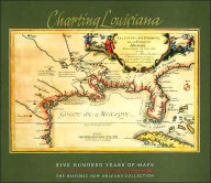
Detalles del libro - Charting Louisiana: Five Hundred Years of Maps Alfred E. Lemmon Editor
EAN (ISBN-13): 9780917860478
ISBN (ISBN-10): 0917860470
Tapa dura
Año de publicación: 2003
Editorial: Historic New Orleans Collection, The Core >2
408 Páginas
Peso: 3,860 kg
Idioma: eng/Englisch
Libro en la base de datos desde 2007-04-29T03:32:52-05:00 (Mexico City)
Página de detalles modificada por última vez el 2024-03-26T04:31:36-06:00 (Mexico City)
ISBN/EAN: 9780917860478
ISBN - escritura alterna:
0-917860-47-0, 978-0-917860-47-8
Mode alterno de escritura y términos de búsqueda relacionados:
Autor del libro: stroud, wiese, hebert, lemm john, alfred lemm
Título del libro: charting, louisiana map, years
< para archivar...